Walk from Katoomba to Kanangra Walls, Blue Mountains NSW.


Many blog sites on the web relate that this is a fantastic walk, and I would agree for those who are technically compentent in all regards. With inclement weather, lack of fitness or injury, the opinion can be very different. The walk is tough and requires carrying lots of water over the hardest bits, as there are none on the ridge traverses. With the lack of track markers, dense shrub and varying mountainous terrain, it would be so easy to get lost here and the chances of getting back on track slim.

Track Notes:
Map reference: Gangerang Wild Dog Mountains, Lower Kowmung, Nth Thurat in the Greater Blue Mountains of NSW. Compiled by Myles J. Dunphy 10th edition 1979. Procurable from The Colong Foundation 18 Argyle St Sydney. The map we were navigating by was a rather old print, a bit different to the coloured ones we are normally accustomed to, but great in regard to the amount of hand markup and it was perhaps clearer once you get used to the single black colour.The person who named the features must of been dog orientated with names like Howling Dog, Little Dingo Hill, Brindle Pup, Brown Dog, Spotted Dog as well as tired or observant of nature with Mt Strongleg and Mt Cloudmaker.

Day 1
We checked in at the local police station and asked for any local knowledge. We discovered that what we had was more than the locals knew, and that was not much. Mike called a taxi driver we met last night who was willing to take us to the gate of the fire trail. By the time all the preliminaries were done we managed to leave at 11:00am.


Day 2

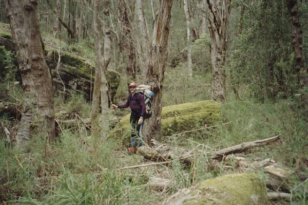
The lyrebirds were active with their raucous sounds, and nature provided interesting things to look at such as some large termite mounds.

Ray and I went for a soak in Kanangra Creek and filled the water bottles. The water was clear and pleasantly cool. We then walked along the banks of the creek to determine if there is a viable route. We felt that the route would be arduous and decided that the way is to go back. Our plan was to hit Mt Strongleg in the morning at 8:00am with no packs to do a day trip up Mt Cloudmaker.
Day 3
We decide to make for Mt Cloudmaker today without backpacks as a day trip. Woke at 7:00am and reluctantly prepared in a shower. 8:00am we broke from camp. The first issue was to ford Kanangra Creek. Ray kindly brought and lent his towel round. We left the towel in the trees to dry and as a marker for the way back.
Mt Strongleg: how apt a name. One continuous unrelenting ascent. We were glad not to have our packs. Navigation was tricky with numerous tracks, but the goal seemed to be common. We elected to stay left as they seemed less steep. The peak of Mt Strongleg was not reached as the tracks skirted round the final mound to the top and our goal was to stay at the contour level that gave us the next route to Kullieatha Peak.


Now we were on our way to Dex Creek, but it wasn't the amble we were hoping for. Scrub and plenty of it, at times over our heads. We can see why in some of our notes some could not find the camp. At Dex's camp we were glad we didn't have to struggle laden with our packs to camp here. The site was quite rocky , only the upper part of the camp being suitable for our tents.

We pressed on after lunch and found that Mt Cloudmaker, like Mt Strongleg
was an entirely apt name. All we saw was cloud, and no view was available to
give us a feeling of satisfaction of having reached our goal.


We refilled our bottles at Dex Creek Camp, making sure to fill at the upper part of the camp. The wade through the scrub was easier on the return walk as we followed the crushed tracks we made earlier.
Throughout the return it seemed easier, maybe because of urgency or the light the tracks seemed more apparent. It wasn’t all a race though, we took time to “smell the roses” just before Mt Moorilla ascent, as there was a viewing point of some of cliffs to the north east.

The descent of Mt Strongleg was taken on the western flank of the ridge that is used to access the mountain from the north ie it leads directly to the camp at Kanangra Clearing. This route was steeper than the eastern ascent this morning and friable, causing slips. It was advantageous to us however as we gained a lot of time.
Whew ! We made it, before dark, what a huge effort. A refreshing wash in the creek and chocolate soy pudding for recovery and we felt on top of the world.
Day 4


Our first snake – a large black one, was entrapped between us. Thankfully it elected to remain stationary, giving us enough time to take a picture and move away.

The crossing of Cox’s river was a different story, requiring removal of our boots. The smooth river pebbles took a bit of concentration, but the traverse was not hazardous.
The ascent of Yellow Pup Ridge was hard work, but only for about an hour. The track then zigzagged, making the climb easier. It took a total of 2 hours to get to the top of Mt Yellow Dog
We arrived at camp at 3:30pm just in time. As soon as our tents were pitched the heavens opened. At Mobb’s Soak we got soaked. The site was quite extensive and infested with leeches. The leeches got into our boots and into areas to discrete to talk about. Blood was pouring from the back of my knees, further up and even under my armpits. For amusement we spent the evening playing spot the leech and eliminating them.
Day 5
We said good bye to the leeches, but they did not want us to go......
On the way back we were treated to dance from three lyrebirds. One of them was curious and came to check us out, staying at a respectful distance.
When we arrived at Medlow Gap, we removed more leeches from underneath our gaiters. Mike was attacked mercilessly as he had shorts on. The climb up Tarro’s Ladder was intimidating for me, but not as bad as going down. However, Mike kindly offered to take my pack up. (we lowered them going down)
The exit out of the fire trail took around 2 1/2 hours, but went quickly and the taxi we called arrived promptly to take us back to the YHA.
Good to feel the warmth of a hot shower, and would you believe it, I found four more leeches . Dinner and a movie at the Edge cinema and life was returned to normality.
Comments
Post a Comment